File:Conempar Map Zones.png
From Anabaptistwiki

Size of this preview: 617 × 600 pixels. Other resolutions: 247 × 240 pixels | 928 × 902 pixels.
Original file (928 × 902 pixels, file size: 598 KB, MIME type: image/png)
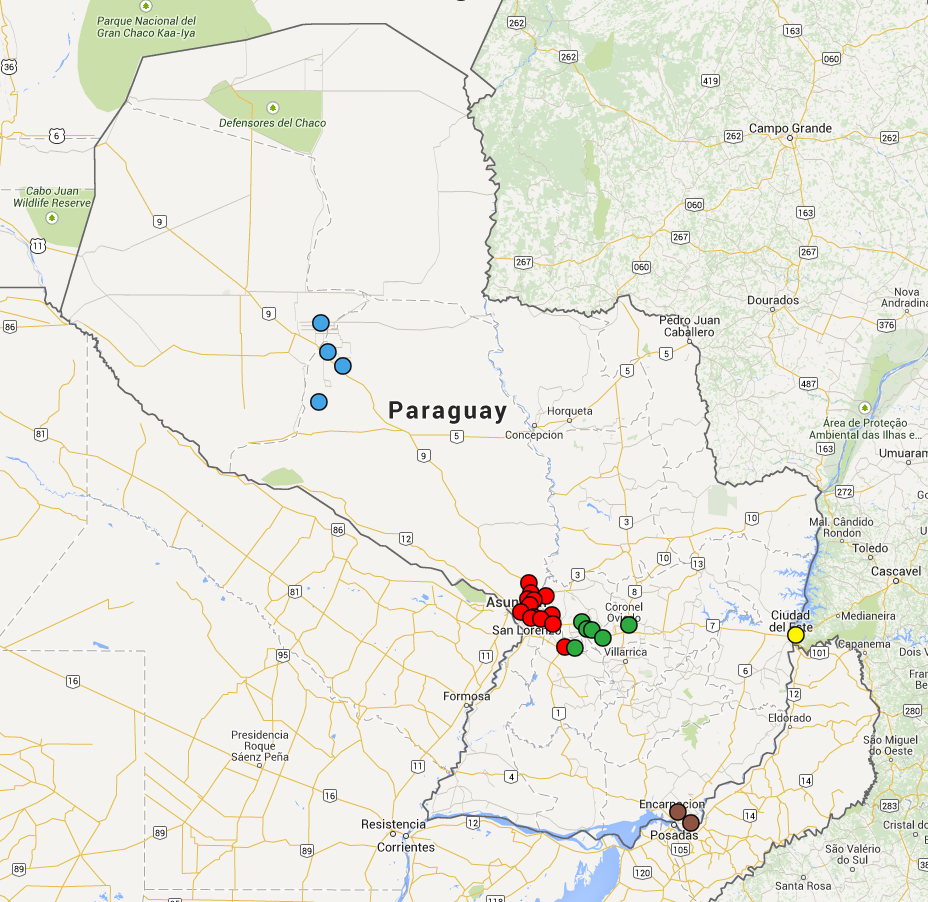
In this map, the cities in which there are one or more churches that are members of CONEMPAR are marked. Zone 1 is red, Zone 2 is green, Zone 3 is yellow, Zone 4 is brown, and Zone 5 is blue.
File history
Click on a date/time to view the file as it appeared at that time.
| Date/Time | Thumbnail | Dimensions | User | Comment | |
|---|---|---|---|---|---|
| current | 03:34, 10 December 2014 |  | 928 × 902 (598 KB) | 76.125.14.12 (talk) | In this map, the cities in which there are one or more churches that are members of CONEMPAR are marked. Zone 1 is red, Zone 2 is green, Zone 3 is yellow, Zone 4 is brown, and Zone 5 is blue. |
You cannot overwrite this file.
File usage
The following page uses this file: