File:Conempar Map Zones.png
From Anabaptistwiki
The printable version is no longer supported and may have rendering errors. Please update your browser bookmarks and please use the default browser print function instead.
Size of this preview: 617 × 600 pixels. Other resolutions: 247 × 240 pixels | 928 × 902 pixels.
Original file (928 × 902 pixels, file size: 598 KB, MIME type: image/png)
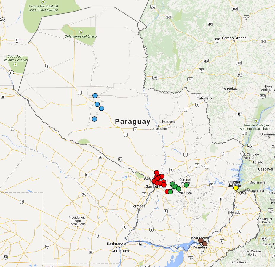
In this map, the cities in which there are one or more churches that are members of CONEMPAR are marked. Zone 1 is red, Zone 2 is green, Zone 3 is yellow, Zone 4 is brown, and Zone 5 is blue.
File history
Click on a date/time to view the file as it appeared at that time.
| Date/Time | Thumbnail | Dimensions | User | Comment | |
|---|---|---|---|---|---|
| current | 03:34, 10 December 2014 | | 928 × 902 (598 KB) | 76.125.14.12 (talk) | In this map, the cities in which there are one or more churches that are members of CONEMPAR are marked. Zone 1 is red, Zone 2 is green, Zone 3 is yellow, Zone 4 is brown, and Zone 5 is blue. |
You cannot overwrite this file.
File usage
The following page uses this file: